This map shows the different ecological regions in the state of Texas. Use the Key to Regions to see each region’s name. The recommended legumes adapted to that region are listed in the table below the map. For more detailed information about annual vs. perennial legumes, cool-season vs. warm-season legumes, and others, read the article: “ForageLegumesTexas” (PDF).
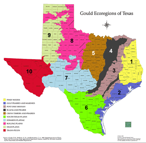 |
KEY TO REGIONS
1. Piney Woods |
| Source: Gould, F.W., Hoffman, G.O., and Rechenthin, C.A. 1960. Vegetational areas of Texas, Texas A&M University. Texas Agricultural Experiment Station, Leaflet No. 492. |
|
| Piney Woods: annual clovers, vetch, white clover, lablab, cowpea Gulf Prairies and Marshes: white clover, lablab Post Oak Savannah: annual clovers, vetch, white clover, cowpea, lablab Blackland Prairie: annual medics, annual sweetclover, vetch, white clover, lablab, rose clover Cross Timbers and Prairies: lablab South Texas Plains: lablab Edwards Plateau: (not recommended for dryland plantings) Rolling Plains: (not recommended for dryland plantings) High Plains: (not recommended for dryland plantings) Trans-Pecos: (not recommended for dryland plantings) |